
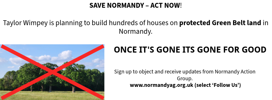
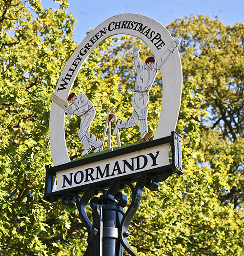
Our Normandy Village - Once its gone, its gone for good

Our Normandy Village - land near Pusseys Copse with Ancient Woodland

Our Normandy Village - view to the Surrey Hills National Landscape

Our Normandy Village - St Marks Church, Wyke, 15th c.

Follow us on
![]()
![]()
![]()
![]()
The last official Guildford local plan was adopted in 2003. There appear to have been plans to replace it in 2009 but the preparation was abandoned in the face of the impending 2010 general election. Any new draft local plan had to conform to the requirements of the NPPF.
The preparation of the 'evidence base' was recommenced after the 2010 election and a public consultation exercise was begun with the publication of the "Issues and Options" document in 2013, along with a raft of evidence documents including the Strategic Housing Land Area Assessment [SHLAA], Guildford Strategic Housing Market Assessment [SHMA], Employment Land Assessment [ELA], Settlement Hierarchy and so on.
This first consultation exercise presented apparent draft plans to build thousands of new houses on Green Belt land that constitutes 89% of the land area of the borough. Residents pointed out many factual errors and inconsistencies in the base information that was used to reach what to some appeared a pre-determination of the consultation exercise. Subsequently it turned out that this consultation exercise would never have been submitted to the Planning Inspectorate for examination in public.
Consequently, the council published a new document for public consultation in July 2014 "Strategy and Sites". This draft was considered under Regulation 18 of the 2004 Compulsory Purchase & Planning Act 2004 that controls the public consultation stages of a draft local plan, receiving over 20,000 responses, reflecting the concerned involvement of residents across the borough. Some of the critical evidence documents that had been proved so flawed in the first consultation were revised; some were replaced with new variations; some background data was replaced by newly published national statistics from the Office of National Statistics [ONS] and corrections to previously published population forecasts.
Again, residents participated wholeheartedly in the consultation process before it closed in late September 2014, only to be informed by the council leader later that the whole local plan process was to be deferred until after the May 2015 general and local elections.
After the resignation of the then council leader, a new draft plan was proposed for public consultation under Regulation 19 of the 2004 Compulsory Purchase & Planning Act 2004 that seeks to confirm the legal "soundness" of the plan before it goes forward for Examination in Public by a planning inspector.The consultation period of 6 weeks was set to start at the beginning of June 2016 and close 6 weeks later on 17 July 2016.
Importantly, new evidence documents were added or existing documents replaced (e.g. the Guildford SHMA being replaced by the West Surrey SHMA; the SHLAA being replaced by the LAA; the Sustainability Appraisal). In the interim, a new Town Centre Master Plan was produced by Allies & Morrison and this informs the new draft Local Plan (Proposed Submission). The emphasis in the draft plan switched from multiple smaller housing sites sites to a few significant "strategic" housing sites, including the now government funded Slyfield Area Regeneration Plan [SARP], Gosden Hill Farm, Three Farms Meadows (former Wisley airfield), Blackwell Farm (University of Surrey land) and land between Normandy & Flexford. Most of the land at these "strategic" sites is situated in the Green Belt.
Approximately 6,500 residents of the borough generated 32,000 comments to the 2016 Local Plan consultation. The high number of comments caused the council to review further some of the evidence base documents and propose a further, fourth, consultation in 2017. The proposed submission local plan was redrafted and, from a Normandy & Flexford point of view, the 'strategic site' A46 (land between Normandy & Flexford settlements) and the minor site A47 (land at Flexford covering an SNCI) were withdrawn.
Overall, the council had a further consideration of the Guildford part of the West Surrey SHMA in February 2017 and returned with a slightly modified annual overall housing number, with part of the total figure pushed out beyond the 2034 end date of the local plan, attempting to give the impression that the total housing number had been reduced. The distribution of new housing in the west of the borough was modified to take account of the withdrawal of Site A46, with 500 or so more houses being pushed onto Ash Green and into the multi-part Site A29 around Ash ad Tongham; a reduction to 1,800 new dwellings at the proposed Blackwell Farm site was balanced by the addition of a secondary school to account for the loss at withdrawn Site A46.
This reduction from 3,000 to 1,800 units at Blackwell Farm appears to have been re-balanced by inserting new sites without prior notification around Send, particularly at Garlick's Arch. The plan continues to be dominated by around 70% of new housing proposed for the Green Belt and approximately 6,500 new homes being proposed within the 400m-5km mitigation zone of the Thames Basin Heaths Special Protection Area and SSSI.
The fourth round of consultation started at the beginning of June 2017 and ended mid-July 2017. The council 'restricted' comment to the 'changes' in the draft plan documents but this also permitted reference to the new evidence base documents that supported any new or changed content in the proposed submission plan documents. The result of the consultation saw a further 9,500 comments from 3,300 individuals and organisations submitted.
The Guildford borough Submission Local Plan: strategy and sites (2017) was submitted to the Secretary of State for Local Government on 13 December 2017 for independent examination. The weight of comment to the Regulation 19 consultation appeared to have little impact on the overall content.
The council finally responded to the Government requirement to create a brownfield register by 31 December 2017. The Guildford borough Brownfield Land Register register contains 55 "brownfield" sites that are now entered on the Part 1 of the register comprising all sites categorised as Previously Developed Land (PDL).
Subcategories
Strategy & Sites (Reg18) - Flexford & Normandy
Proposed Submission Local Plan (Reg 18) - Flexford & Normandy
Land Sensitivity Analysis
The third consultative document "Proposed Submission Local Plan" has seen the removal of the proposed "safeguarded" status of 72.4 hectares of grade 3 agricultural land containing ancient woodland from Wanborough Station to the A323 Guildford Road. As a result of a further survey within the Green Belt & Countryside Study Vol. 5, to assess the 'sensitivity' to development of land parcels on the Green Belt based on a 'traffic light' classification (red=most sensitive, green=least sensitive, amber=moderate sensitivity), the Green Belt land between Flexford and Normandy has been classified as being of "red" sensitivity. Based on this classification, it would be expected the land would not be proposed for development and remain within the Green Belt.
'Developer-led' Proposal
However, a 'developer-led' proposal has been submitted to the council by Taylor Wimpey for the development of this land for 1,100 homes in combination with a 7-entry form secondary school that has arisen from the Surrey County Council evaluation of the impact of future population growth in the west of Guildford borough. The proposal is included in this latest draft Local Plan as Policy A46. The growth in education need is based partly on the Flexford/Normandy proposal and partly on the creation of a further extensive housing development at Blackwell Farm on land owned by University of Surrey. Other outline proposals for Site A46 include a 420-place primary school, a residential home for up to 60 residents (plus the support staff and other facilities), 6 pitches for travelling showpeople, a new village green and 10 hectares of SANG; to help this along the proposals also contain is new comparison retail (A1) space up to 3,000 sq metres and further retail space (A2-A5) up to 1,200 sq metres. One of the sites removed in the previous round of consultation, land to the rear of the Paddocks, including Flexford Pond and an area designated as a Site of Nature Conservation Interest [SNCI] has reappeared as Policy A47 containing a proposal for 50 new homes.
Impact of Insetting
The further redefinition of land within and between the current settlements as 'urban' is promoted by "insetting" the settlement of Flexford and the settlement of Normandy. The "inset" boundaries in the main follow the redrawn settlement boundaries proposed in the Green Belt & Countryside Study, Volume 4. This will result in the removal of Green Belt planning restrictions, with the potential to lead to an intensification of land use within the "inset" boundaries with housing density in excess of the 30 dwellings per hectare [dph] threshold suggested for Green Belt developments.
Once the settlement areas defined by the "inset" boundaries become contiguous with the land for the 'developer-led' proposal and school, the land boundary for the whole area from Flexford Road in the south to the A323 Guildford Road in the north becomes one large urban land area, with the proposal for a total of 1,100 dwellings (715 houses + 385 flats), 2,640 residents (at 2.4 people per household as per ONS) and 1,375 passenger vehicles (at 1.25 per household as per ONS), up to 400 dogs and over 300 cats. A sprawling "garden village" visible from the AONB of the Hogs Back, gobbling up land that at present fulfills three essential purposes out of five for the Green Belt:
- To check the unrestricted sprawl of large built-up areas
- To prevent neighbouring towns from merging into one another
- To assist in safeguarding the countryside from encroachment
Once an area of land has been defined as Green Belt, the stated opportunities and benefits include:
- Providing opportunities for access to the open countryside for the urban population, outdoor sport and outdoor recreation near urban areas
- The retention of attractive landscapes and the enhancement of landscapes, near to where people live
- Improvement of damaged and derelict land around towns
- The securing of nature conservation interests
- The retention of land in agricultural, forestry and related uses
These opportunities and benefits would disappear from our community in less than a resident's lifetime, making the area unrecognisable from what we see today.
Further information to inform responses to the consultation
Strategy & Sites (Reg19) - Flexford & Normandy
Proposed Submission Local Plan (Reg 19) - Flexford & Normandy
Front line in threat of urban sprawl
The Green Belt Sensitivity analysis carried out by consultants for GBC between the Local Plan Reg 18 and first Reg 19 consultations, indicated the land parcels surrounding and containing Normandy & Flexford (H10, H12, H13, H14 & H16) to be of ‘high sensitivity’, one of the main reasons for the withdrawal of A46, reinforcing the analysis contained in the Green Belt & Countryside Study Volume 5 Appendix 1 that highlighted the role of the same land parcels fulfilling the essential roles of the Green Belt, to prevent sprawl, to prevent the coalescing of settlements and protect the ‘openness’ of the countryside.
Remove ‘inset’ & remain ‘washed over’
To bolster the position of our ward in protecting the west of the borough north of the Hogs Back against this proposed east-to-west and west-to-east sprawl and enhance the Green Belt status of Normandy, Flexford and Wyke, residents should consider proposing the removal of the ‘inset’ planned for our settlements and to remain ‘washed over’ by the Green Belt to continue Normandy & Flexford’s contribution to the ‘openness’ of the Green Belt.
As commented in NAG News, Edition 61, there is evidence in past appeal decisions by planning inspectors that Normandy & Flexford’s land contributes to the ‘openness’ of the Green Belt, a key test for remaining ‘washed over’ and this can be highlighted when writing to GBC on the proposed second Reg 19 Local Plan changes.
What’s relevant to Flexford & Normandy?