
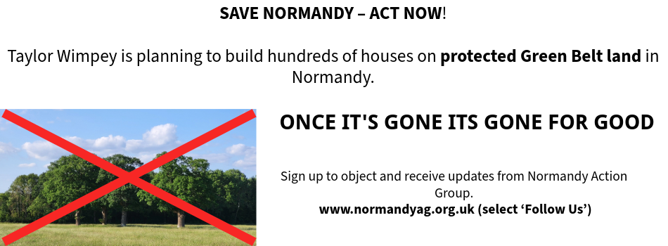
Our Normandy Village - Once its gone, its gone for good

Our Normandy Village - land near Pusseys Copse with Ancient Woodland

Our Normandy Village - view to the Surrey Hills National Landscape

Our Normandy Village - St Marks Church, Wyke, 15th c.

Follow us on
![]()
![]()
![]()
![]()
Infrastructure – The Road Network
The road network in Normandy will not be able to sustain the volume of traffic that a development with 1,100 homes would create and there are no highway improvements that can conceivably be made to these country lanes to convert them to the A-class roads needed to serve the proposed development.
Overview
The proposed site is boxed in by an unclassified road (Glaziers Lane D60) on the east, a C-class road (Westwood Lane C16) on the west, and a railway line to the south. Both of the roads struggle to cope with the existing volume of traffic, let alone the increased traffic from an 1,100 home development and road traffic to and from the proposed school.
There is a narrow humpback bridge on Glaziers Lane to negotiate, which is on a deceptive double bend and has very limited sight lines, as well as a right angled bend where the Lane meets another unclassified road, Flexford Lane. There is also an extremely dangerous, single-lane road under a railway bridge on Westwood Lane which also has a deceptive double bend and a height limit of 14’-3” under which a double-decker bus is not able to pass.
There are also dangerous junctions where these roads meet the A323 Guildford to Aldershot road at their northern ends. At rush hour this road is already congested and is identified in GBCs ‘Options Growth Scenario Transport Assessment Report’ as being at full capacity already.
The entry and exit from the A31 ‘Hogs Back’ on to the B3000 to travel to and from the development site via Wanborough Hill is a ‘bottle neck’ at most times of the day, and would be likely to ‘grid lock’ with the increased volume of traffic to and from the site and the school. No amount of improvements to the road system will enable these rural roads to cope with the increased volume of traffic, let alone the construction traffic that would disrupt this fragile infrastructure over possibly a fifteen year period.
Glaziers Lane
Glaziers Lane is an unclassified road (D60) and is unsuitable for the volume of traffic that the proposed development would generate together with additional traffic going to and from the school. The Lane is a rural, residential road, just 6 metres wide at the widest point, with a 30mph speed limit throughout its length.
The Lane is a busy commuter route for cars, commercial vehicles, lorries, multi-axle heavy goods vehicles and articulated lorries travelling between the A323 Guildford to Aldershot Road and the A3 and A31. Many of these vehicles fail to adhere to the speed limit. The street lighting in Glaziers Lane is poor and could at best be described as footpath lighting. Towards the southern end of the Lane is a humpback road bridge over the railway line, which has a sharp incline and decline so that on approach there is no view of the other side of the bridge. The bridge is also on a slight, but deceptive, double bend in the road. At this point the Lane narrows to 5.5 metres, slightly under in places. This is an especially dangerous part of the Lane as cars speed towards the bridge from both directions, with no view of the other side. The roadway of the bridge is badly sunken on both sides due to the weight of the heavy goods vehicles crossing the bridge.
At the northern end of the Lane is the junction with the A323 Guildford to Aldershot Road, where Glaziers Lane crosses over to Hunts Hill Road. This is a difficult junction to negotiate owing to the amount of traffic travelling along the main road, and also because there are cars turning right out of Glaziers Lane on to the main road, cutting across the path of cars coming across from Hunts Hill Road, with both sets of drivers attempting to find a gap in the main road traffic. There is often a tail-back of traffic in Glaziers Lane waiting to exit.
The single footpath along the Lane is not continuous, changing from side to side of the road along its length. This means that pedestrians have to cross the road at various points in order to remain on the footpath, with two exceptionally dangerous crossing points which are poorly maintained by SCC. One is by the stream just south of no. 35 Glaziers Lane, on a sharp bend, which means that pedestrians have a poor view of vehicles approaching both directions along the Lane, and drivers of these vehicles cannot clearly see the pedestrians until the last moment.
The other dangerous crossing point is on the north of the road bridge that crosses the railway line, as vehicles approaching from the south only have a short stopping distance after crossing the summit of the ‘blind’ bridge before arriving at the crossing point. These crossing points are especially dangerous for those in wheelchairs, the elderly and infirm, and parents/carers with pushchairs or prams, who require more time to cross the road. At some points the footpath is reduced to a width of much less than a metre, due to the outward growth of hedges meaning that passing pedestrians often have to walk in the road. A build-up of debris where the kerbs are lowered at the crossing points also means that pedestrians have to move on to the road to avoid the mud.
The railway station is situated close to the southern side of the humpback bridge and has limited space for car parking, which will be insufficient for the proposed increase in vehicle numbers. Cars parking instead on Glaziers Lane would add to the hazards that already exist.
Traffic exiting the station car park and turning north has a tight turning circle in order to keep on the correct side of the road and is vulnerable to vehicles speeding over the bridge south bound with limited views of the approaching traffic. The increased volume of cars using the station car park would add considerably to the dangers. This bridge would be hazardous for cyclists travelling to and from the school.
Westwood Lane
Westwood Lane is classified as a C Class road (C16) and is unsuitable for the volume of traffic that the proposed development would generate and additional traffic going to and from the school. The Lane is a rural, residential road, with a 30mph speed limit along the southern residential part of the road up to the railway bridge, and a 40mph limit up to the northern end of the road along which there are no street lights.
The Lane is a busy commuter route for cars, commercial vehicles, lorries, multi-axle heavy goods vehicles and articulated lorries travelling between the A323 Guildford to Aldershot Road and the A3 and A31. Many of these vehicles fail to adhere to the speed limits. The street lighting is poor and there is no street lighting on the long 40mph stretch of the road.
From Flexford Road (an unclassified road) at the southern end of Westwood Lane to the railway bridge is a hill down which vehicles speed. The road under the railway bridge is a single track road on a deceptive double bend, with priority given to vehicles travelling south. There is a 14’ 3” height restriction on the bridge which means that a double decker bus would not be able to pass under (which would considerably restrict being able to bring pupils to and from the school). Immediately on the southern side of the bridge travelling north, on the nearside, is a road exit at Beech Lane.
Vehicles turning left at this point under the bridge travelling north cannot be seen by vehicles that have priority travelling south, and a greater volume of traffic will only increase the inherent dangers at this bridge. This bridge would be hazardous for cyclists travelling to and from the school, and a congestion point for the increased traffic that an 1,100 housing development would bring.
At the northern end of the Lane is the junction with the A323 Guildford to Aldershot Road. This is an extremely dangerous junction with traffic from Westwood Lane attempting to turn both ways onto the busy A323, while traffic from the A323 is attempting to turn into Westwood Lane. This junction is already a ‘bottle neck’ at busy times of the day. There is the added danger that only a few yards to the west is School Lane, along which Wyke Primary school is located. There is a nearby crossing point ‘island’ on the A323 which is hazardous for pupils and their parent to use and cars have already mounted this island demolishing the street sign.
Many parents who drop off and meet their children park alongside the churchyard in Westwood Lane and negotiate this busy crossing point ‘island’ to get to School Lane. This crossing point will become even more dangerous if an additional form of entry is added to the school, and there is increased traffic entering and exiting Westwood Lane. The footpath is on both sides of Westwood Lane as far north as the railway bridge but from there to the northern end of the road is only on the east side.
B3000 entry/exit to the A31 and Wanborough Hill
The entry and exit from the A31 ‘Hogs Back’ on to the B3000 to travel to and from the development site via Wanborough Hill (C16) is a ‘bottle neck’ at most times of the day, and would be likely to ‘grid lock’ with the increased volume of traffic to and from the proposed development site and the school. There is no pavement nor street lighting from Wanborough Hill until the road reaches Normandy.